Itinerary
The Itinerary for Gondogoro Peak Expedition is noticeable below
Today's GPS Data Altitude: 540 m
Our guide(s) will pick you up at the airport. You will be transferred to hotels shortly. Our participants can unwind and recover from their lengthy journey on this day.
Pickup instructions
Our guide will be holding orange placards with our company's logo and your name on them. You must fly into Islamabad International Airport. International flights typically arrive in the afternoon or at midnight. You must notify us of your inbound and outgoing flights at least five days before your arrival in Pakistan.
Unless you are flying a connecting flight from another location in Pakistan, our staff/guide will meet you at the international arrivals gates. The guide/staff will transport you to our affiliated hotel. Please notify us in advance if you do not require airport transportation.
After lunch and some relaxation at the hotel (preferably if you arrive between 9 am and 12 pm), our guide/representative will pick up all of our guests around 6 pm for a briefing and final payments at our office, followed by supper. If you arrive late, we will handle any outstanding fees and briefings in Skardu.
Today's GPS Data Altitude:2,498 m
Participants will take a beautiful trip from Islamabad Airport to Skardu Airport this morning. If the clouds cooperate, you will be able to view Nanga Parbat. The day is free after arriving at Skardu.
Today's GPS Data Altitude: 2,498 m
After breakfast, the participants will go to Skardu's Kharpocho Fort, which is positioned on a mountain. The Kharpocho Fort offers a spectacular view of the Indus River and Skardu town. Participants will also have the option of taking a tour of Sadpara Lake, followed by free time in Skardu Bazaar.
During the sightseeing, our personnel will take care of any further government paperwork that is required in Skardu. This can take up to two days. We have contingency days planned at the conclusion of the walk-in in case of delays.
Today's GPS Data Altitude: 3,050 m
Distance: 127 kilometers
Duration: 6 hours
We leave Skardu fairly early, crossing the Shyok River to begin an exhilarating 6-hour jeep journey up to Hushe, passing through several small and scenic villages in the lower Hushe Valley. We must pass through several 'nullahs,' or little tributary valleys, along the way. These nullahs are fed by meltwaters from glaciers high above the valley, and they can become impassable in the afternoon when the hot sunsets. We should have no complications because of our early departure from Khaplu. At 3050 metres, Hushe is the highest settlement in the area, and we set up tent in a meadow right below the village, with the massive Masherbrum (7821 metres) dominating the valley to the north.
Today's GPS Data Altitude:3,348 m
Distance: 10 km
Duration: 2.5 hours
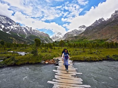
Today we start our ascent to Gondogoro Peak, going up above the hamlet on a rocky trail through breathtaking surroundings. A cultivated region just above the settlement has some bare grazing, fields of corn and turnips, flowering shrubs such as oleander, and a few thin trees. Both sides of the valley are surrounded by towering mountain peaks. As we head northeast along the river that flows from the Gondogoro Glacier, the valley widens and splits. To get to the lovely campsite at Saitcho, we cross the tributary Charakusa River on a wooden cantilever bridge. This camp is located at the confluence of the Charakusa and Gondokoro valleys, on a sandy, tree-shaded region by a swift-flowing river. There are magnificent views of Namika (6325m), K7's rock spire, and the majestic Charakusa Spire from the trail leading to the camp. This is a short and simple day of hiking that is ideal for acclimatization.
Today's GPS Data Altitude: 3,350m
Distance: 11.9 km
Duration: 5-7 hours
The short stage to Dalsampa today follows the eastern edge of the Gondogoro Glacier. We walk above our camp, getting increasingly good views of the glacier and Masherbrum beyond. At a point where the glacier cuts straight into the steep valley wall, we are usually forced to drop virtually onto the glacier itself and climb along its edge for another hour (if the trail above the moraine cliffs is in good condition, this may be utilised instead).
A final struggle up a steep gully leads to the campsite at Dalsampa (4150m), which is nestled in a grassy ablation valley with a handful of little lakes and breathtaking views of a series of rocky summits, culminating in the snow-plastered summit of Masherbrum.
Below the mountain, an amazing icefall guards the entrance to the Masherbrum La, which (theoretically) connects Hushe with the Baltoro system to the north. Snow leopards can still be found in this remote area of the Karakoram.
Today's GPS Data Altitude: 4,590m
Distance: 6.1 km
Duration: 4-5 hours
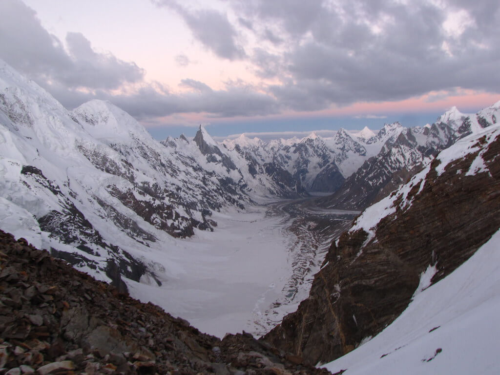
The valley turns more to the east just above our camp, and we have fantastic views up-valley to the Gondogoro La and to Gondogoro Peak itself, though the latter is difficult to see against the valley headwall. We must descend once more onto the glacier, this time heading out into its heart. The glacier's angle is not steep at this stage, and we are traveling on the moraine, snow, and bare patches of ice.
Walking between ice pinnacles, some of which are covered with stones, and simply avoiding crevassed sections, is a fantastic glacier experience. This glacial traverse is not technically difficult, and no ropes are normally required. We pass beneath the spectacular spire of Laila Peak (6096m) and through breathtaking mountain scenery. We gradually made our way to the north side of the glacier at Khuispang, a grassy terrace next to a little meltwater lake.
Today's GPS Data Altitude: 4,590 m
Khuispang is a breathtaking location in the center of Karakoram. The views of Laila Peak are spectacular, and the massive bulk of Trinity Peak is visible just across the glacier from camp. Seracs frequently break off high above this mountain's complex north-west face, creating avalanches that can come all the way down to the glacier, but mercifully not this side of the glacier.
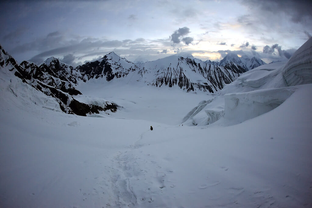
This is a rest and acclimatization day. We'll also spend some time on the approach to Gondogoro La practicing the simple safety skills required for ascending fixed ropes and walking roped-up.
Today's GPS Data Altitude: 5,748m
Duration: 10 hours
Gondogoro Peak is designed for prospective mountaineers who want to climb their first Karakoram trekking peak with little prior crampon and ice axe experience. It is situated to the north of Camp Khuispang. The ascent to the summit from base camp takes about 10 hours.
The ascent of Gondogoro Peak (5,750m) is technically simple. From the summit, you can see Mashabrum, Hidden Peak, Chogolisa, Trinity Peak, and Laila Peak, among other things.
If we are able to cross Gondogoro La on time (weather permitting), we will have three days to complete the climb. Our climbing guide will devise a detailed itinerary for the three climbing days once we arrive at Khuispang camp. His option to rest, acclimatize, or press for the summit will be determined by the time it takes to traverse the Gondogoro La, weather conditions, the health of the participants, and other factors. Those who do not intend to attempt the summit at this time can relax and enjoy the wonderful landscape from Camp Khuispang, while the rest of the group will attempt the top. Our guide will determine whether to put up a high camp or go for a direct summit push (9-10 hours) based on the general team spirit of the participants, time limits, and other factors. A direct summit push from base camp begins about 3 a.m., and by 1 p.m., motivated hikers can reach the summit with our guide.
After a successful summit, our mountain guide will decide whether to return to base camp or set up high camp, taking into account all of the considerations outlined above.
On this day, the participants will continue hiking down. Because the descent will be a relatively easy hike, the climbing equipment, such as ropes and crampons, will be packed while descending. The rough and mountainous terrain will be carried over the lovely green landscapes of Hushe Valley.
After lunch, the hikers will proceed to the edge of the Gondogoro Glacier, where they will find a track that will lead them to a magnificent valley of rhubarb and grass.
There are two routes to the destination at the valley's end. Our guide, with the help of local porters, will choose the most popular treks. When the two pathways intersect, the journey becomes much easier. The members will visit stone cottages built by herdsmen and local inhabitants. The participants will see the signs of the villages in the vicinity on this day and will be able to breathe easily due to the large trees and lower altitude. Camp will be put up at Saicho (3,350m), a sand and grassy area along the flowing glacier water steams.
Today's GPS Data Altitude: 2,498 m
Distance: 20 kilometres hike + 127 kilometres drive
Duration: 5-7 hours trek + 6 hours drive
On this day, participants must hike down the river stream of glacier-melted water from the Charakusa, Ailling, Masherbrum, and Gondogoro Glaciers for only 3-4 hours. The participants will begin to notice signs of dwellings, shelters, fields, and people living.
The participants will see the Hushe village's two-story shelters, where the ground floor is for cattle and the first floor is for the family to live. Participants can explore the picturesque hushe valley and connect with the locals after setting up their camp. This would be the Gondogoro La Trek's final camping day.
When the participants arrive at Hushe, they will depart towards Skardu town, and the route will take them through many magnificent scenes of the Hushe Valley's various little villages. To reach the other side, the participants will traverse a suspension bridge spanning the Shyok River (which flows from Ladakh, India).
Traditional rafts constructed of goat skin and filled with air were used to traverse the river in the past. The suspension bridge that is now used to traverse was erected in the 1990s. The participants will arrive in Khaplu after crossing the bridge.
The road from Khaplu to Skardu becomes smoother, and the option to take is the paved road along the Shayok River, which leads to the Indus River's confluence. Participants will arrive in Skardu in 4 hours after traveling along the Indus River. The participants can use the amenities that they did not have for the previous two weeks. The first item on the list would be a hot shower, followed by a satisfying supper.
Today's GPS Data Altitude: 2,400 m
This day is set aside for any potential delays when trekking or mountaineering. We do not want our customers to miss their return flights or other arrangements owing to delays caused by a variety of causes such as (but not limited to) road obstructions.
Please keep in mind that all expenses in Skardu (e.g., hotel, meals, transportation after hotel drop) on this day will be borne alone by our climbers/guests and are not included in the adventure package. Your experience with Silkroad Guides concludes when you return to Skardu.
Today's GPS Data Altitude: 590 m
The participants will fly from Skardu Airport to Islamabad Airport on this day. You will have a pleasant time relaxing at the Islamabad Hotel.
Domestic flights are occasionally canceled due to weather conditions. If your flight is canceled, you will drive to Chilas for the night. A vehicle takes eight to 10 hours.
Today's GPS Data Altitude: 538 m
This day is set aside for any potential delays if the domestic flight does not operate the day before. Our guests will travel from Chilas to Islamabad in the early morning, which could take up to 10 hours. However, if the players make it to Islamabad on the domestic flight, it would be a free day. This time could be spent sightseeing in Islamabad.
Meals for this day included: Breakfast
Our personnel will transport all of our customers to the airport at their scheduled departure times. All of our partner hotels have a 12 pm check-out time.
Extra nights/time in Islamabad (hotel check-in/check-out time is 12 pm) - USD 59 per night
Holiday Overview
Throughout the ascent, expert guides and Sherpas accompany the participants, offering assistance, safety, and terrain knowledge. The expedition crew will use specialised mountaineering equipment and ropes to secure the climbers' safety. The surrounding mountains, glaciers, and valleys provide a continual reminder of the riches that lie at the peak.
An awe-inspiring achievement is reaching the pinnacle of Gondogoro Peak. Participants are rewarded with spectacular panoramic views of the Karakoram range while standing atop this majestic peak. The sight of towering peaks, enormous glaciers, and pure environment fills them with amazement and astonishment that will last a lifetime.
Following their success on the summit, participants begin their descent back to base camp, retracing their steps through the breathtaking scenery. They will be able to rest, think, and savor the memories of their remarkable feat once they return to base camp.
The Gondogoro Peak Expedition is a once-in-a-lifetime opportunity to test oneself, experience the grandeur of the Karakoram mountains, and immerse oneself in Pakistan's awe-inspiring natural splendor. It is a voyage that will leave participants with a strong sense of success and a deep respect for the beauty of the mountainous environment, requiring determination, physical fitness, and a desire for adventure.