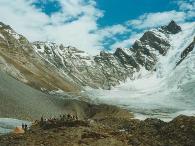
Itinerary
The Itinerary for Gasherbrum I Expedition is noticeable below
Today's GPS Data Altitude: 540 m
Our guide(s) will pick you up at the airport. You will be transferred to hotels shortly. Our participants can unwind and recover from their lengthy journey on this day.
Pickup information
Our guide will be holding orange placards with our company's logo and your name on them. You must fly into Islamabad International Airport. International flights typically arrive in the afternoon or at midnight. You must notify us of your inbound and outgoing flights at least five days before your arrival in Pakistan. Unless you are flying a connecting flight from another location in Pakistan, our staff/guide will meet you at the international arrivals gates. The guide/staff will transport you to our affiliated hotel. Please notify us in advance if you do not require airport transportation.
After lunch and some relaxation at the hotel (preferably if you arrive between 9 am and 12 pm), our guide/representative will pick up all of our guests around 6 pm for a briefing and final payments at our office, followed by supper. If you arrive late, we will handle any outstanding fees and briefings in Skardu.
Today's GPS Data Altitude: 540 m
Before heading to Skardu, we will receive a briefing from the Department of Tourism in Islamabad about the Gasherbrum I Expedition.
Following the briefing, we will spend time exploring Islamabad and sampling traditional Pakistani cuisine.
Today's GPS Data Altitude: 2,498 m
Participants will take a beautiful trip from Islamabad Airport to Skardu Airport this morning. If the clouds cooperate, you will be able to view Nanga Parbat. The day is free after arriving at Skardu. It'll be a nice treat before the Gasherbrum I Expedition.
Today's GPS Data Altitude: 2,498 m
After breakfast, the participants will go to Skardu's Kharpocho Fort, which is positioned on a mountain. The Kharpocho Fort offers a spectacular view of the Indus River and Skardu town. Participants will also have the option of taking a tour of Sadpara Lake, followed by free time in Skardu Bazaar.
During the sightseeing, our personnel will take care of any further government paperwork that is required in Skardu. This can take up to two days. We have contingency days planned at the conclusion of the walk-in in case of delays.
Today's GPS Data Altitude: 3,015 m
On this day of the Gasherbrum I Expedition, participants will embark on a jeep safari to Daso, passing via the Shigar Valley. The journey will take place along the banks of the Braldu River, which runs all the way to Askole. Askole will be the final settlement on our itinerary; after exiting the jeeps, participants will begin walking. However, depending on the road conditions, participants may begin their walk before arriving in Askole. The distance will take you between six and eight hours to complete.
Today's GPS Data Altitude: 3,103 m
Distance: 20 km
Duration: 5-8 hours
Following the completion of the necessary supply list and equipment, the porters will load up for the journey to Jhola. The valley serves as a portal to the Biafo glacier, which flows over fifty kilometers from Hispar La to Braldu. The participants will experience moraine walking as they traverse the glacier's snout and descend to a picnic site near the Korofon River.
The route will take us to the confluence of the Braldu and Domordo rivers. The former trail will not be used for the journey; instead, a modern trail will take us upstream, where participants will cross the river via bridge. On the other side of the bridge, competitors will descend to the Braldu River's shore and follow the river bank to the Jhola camp.
Today's GPS Data Altitude: 3,418 m
Distance: 19.8 km
Duration: 6-7 hours
On this day of our Gasherbrum I Expedition, we will follow the Braldu Gorge along the Braldu River's bank. The participants will be able to see the spectacular Trango Tower and Cathedral Peak rocks. Participants should avoid getting sunburned on this day because the walking conditions can be exceedingly dry and hot.
Several glacier streams flow down into the valley, and depending on the water levels, participants will need to utilize river crossing shoes. On a clear day, the trekkers will be able to see the snout of the Baltoro Glacier. On this day, the participants will climb away from the river to camp at Paiju, the last camp where they will see trees for quite some time.
Today's GPS Data Altitude: 3,418 m
The participants will spend the day at Paiju Camp getting acclimated and resting. The porters, on the other hand, will take their time baking bread for the following week on the glacier. On this day, an acclimatization walk to Paiju Peak base camp is also possible. This will be extremely beneficial to the participants prior to the Gasherbrum I Expedition, as their bodies will acclimatize to the region.
Today's GPS Data Altitude: 3,788 m
Distance: 14.7 km
Duration: 5-7 hours
Walking will be difficult on this day of the Gasherbrum I Expedition, but the landscape will improve with each step onto the snout of Baltoro Glacier. The trail involves continual up-and-down climbs on the glacier moraine, and while the trail is relatively safe, it is strongly advised to be cautious at all times. As they go, the participants will be treated to breathtaking vistas of Trango Tower and Uli Biaho. The participants must cross the glacier to reach Liligo. The participants will next walk a steep road along the edge of the Baltoro or sometimes to Khoburtse, the side of the glacier where camp will be set up.
Today's GPS Data Altitude: 3,905 m
Distance: 6.4 km
Duration: 4-6 hours
Trango Towers may finally be seen on this day of the Gashebrum I Expedition after passing through two minor glaciers. The players would spend the night in Urdukas, near the army camp, the next night. The camp is located 100 meters above the glacier.
Today's GPS Data Altitude:4,285 m
Duration: 6-8 hours
The participants in our Gasherbrum I will be trekking in the midst of the glacier on this day. The medial moraine will be followed, with views of Masherbrum (7821m) to the south. The athletes will be hiking up and down the rocky moraine and walking by large ice seracs as they progress.
This will be the first night's stay camp on Baltoro Glacier at Goro II, which is located at the junction of Baltoro Glacier and Younghusband Glacier. The temperature could plummet drastically. Masherbrum and Muztagh Tower will be revealed for the occasion.
Today's GPS Data Altitude: 4,512 m
Distance: 11.7 km
Duration: 5-7 hours
On this day of the Gasherbrum I, the participants will reach Concordia after trudging up the moraine continually, with more and more high snow-capped peaks appearing along the route, culminating in the sighting of K2. Broad Peak, Mitre Peak, Gasherbrum, Sia Kangri, and many other summits may be viewed.
Today's GPS Data Altitude: 4,850 m
Distance: 11.7 km
Duration: 3-5 hours
The hike from Concordia to the campground will take two hours on glacier moraine. The participants will hike on the upper Baltoro glacier to reach Shahring. Participants can see Chogolisa, Snow Dome Peaks, Baltoro Kangri, and numerous more high-altitude peaks from this vantage point.
Today's GPS Data Altitude: 5,150 m
Distance: 8.08 km
Duration: 4 weeks
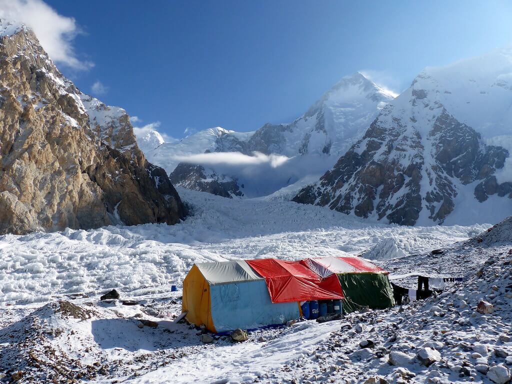
We shall begin our ascent to the mountain on this day and continue for the next four weeks. We will have backup days in case the weather improves. Silkroad Guides Team will set up the expedition's base camp and will continue to help the expedition throughout the time frame.
Today's GPS Data Altitude: 4,512 m
Distance: 11.7 km
Duration: 5-7 hours
We return to Concordia on this day after successfully completing the Gasherbrum I Expedition.
Today's GPS Data Altitude: 4,500 m
Distance: 14.7 km
Duration: 5-6 hours
The participants will take a little different and less traveled path. There will be short detours to avoid crevasses, and participants should walk on tough ice rather than slick ice. In the event of snow, the participants and porters will walk together while wearing crampons and roped together.
The base will be established in Ali camp, which participants will arrive at after hiking for 5-6 hours. The name "Ali Camp" comes from a local porter who was the first to traverse the Gondogoro La Pass.
Today's GPS Data Altitude: 5,585 m
Distance: 19.8 km
Duration: 5-7 hours
Participants will be up as early as 2 a.m. on this day. After getting ready and eating breakfast, the group will depart as one team for the Gondogoro La base. Depending on the situation, our support personnel will be on hand to repair ropes or assist members with equipment. The trip to the top of Gondogoro La Pass takes about 3 hours. You will be able to see and experience all four 8000ers in the Baltoro region. K2, G1, Broad Peak, and G2.
Fixed ropes will be used extensively while descending to the other side, and the usage of crampons is critical for the members' safety. Members will get views of the stunning and sword-shaped Laila Peak (6,096m), as well as vistas of other Trinity summits.
To avoid jolting stones on their teammates, the members will have to be extremely cautious when descending and look out for every step they take. The routes grow easier as the participants descend the slope and go along the moraine. The camp will be located at Khuispang (4,600m), the meeting point of the Gondogoro and Trinity Glaciers.
Today's GPS Data Altitude: 3,350 m
Distance: 20 km
Duration: 5-7 hours
The participants will continue hiking down. Because the descent will be a relatively easy hike, the climbing equipment, such as ropes and crampons, will be packed while descending. The rough and mountainous terrain will be carried over the lovely green landscapes of Hushe Valley.
After lunch, the hikers will proceed to the edge of the Gondogoro Glacier, where they will find a track that will lead them to a magnificent valley of rhubarb and grass.
There are two routes to the destination at the valley's end. Our guide, with the help of local porters, will choose the most popular treks.
When the two pathways intersect, the journey becomes much easier. The members will visit stone cottages built by herdsmen and local inhabitants. The participants will see the signs of the villages in the vicinity on this day and will be able to breathe easily due to the large trees and lower altitude. The camp will be put up at Saicho (3,350m), a sand and grassy area along the flowing glacier water streams.
Today's GPS Data Altitude: 2,498 m
Distance: 20 kilometres trek + 127 kilometres drive
Duration: 5-7 hours trek + 6 hours drive
On this day, participants must hike down the river stream of glacier-melted water from the Charakusa, Ailling, Masherbrum, and Gondogoro Glaciers for only 3-4 hours. The participants will begin to notice signs of dwellings, shelters, fields, and people living.
The participants will see the Hushe village's two-story shelters, where the ground floor is for cattle and the first floor is for the family to live. Participants can explore the picturesque hushe valley and connect with the locals after setting up their camp. This would be the Gondogoro La Trek's final camping day.
When the participants arrive at Hushe, they will depart towards Skardu town, and the route will take them through many magnificent scenes of the Hushe Valley's various little villages. To reach the other side, the participants will traverse a suspension bridge spanning the Shyok River (which flows from Ladakh, India).
Traditional rafts constructed of goat skin and filled with air were used to traverse the river in the past. The suspension bridge that is now used to traverse was erected in the 1990s. The participants will arrive in Khaplu after crossing the bridge.
The road from Khaplu to Skardu becomes smoother, and the option to take is the paved road along the Shayok River, which leads to the Indus River's confluence. Participants will arrive in Skardu in 4 hours after traveling along the Indus River. The participants can use the amenities that they did not have for the previous two weeks. The first item on the list would be a hot shower, followed by a satisfying supper.
Today's GPS Data Altitude:538 m
On this day, the participants will fly from Skardu Airport to Islamabad Airport. You will have a pleasant time relaxing at the Islamabad Hotel.
Domestic flights are occasionally canceled due to weather conditions. If your flight is canceled, you will drive to Chilas for the night. A vehicle takes eight to 10 hours.
Today's GPS Data Altitude: 538 m
This day is set aside for any potential delays if the domestic flight does not operate the day before. Our guests will travel from Chilas to Islamabad in the early morning, which could take up to 10 hours. However, if the players make it to Islamabad on the domestic flight, it would be a free day. This time could be spent sightseeing in Islamabad.
Meals for this day included: Breakfast
Our personnel will transport all of our customers to the airport at their scheduled departure times. All of our partner hotels have a 12pm check-out time.
Holiday Overview
Climbers gradually acclimatize to the high altitude and difficult conditions as they ascend toward the base camp. This critical period helps their bodies to adjust to the thin air and reduces the danger of altitude-related illnesses. Before beginning the actual climb, the base camp acts as an important center for rest, preparation, and supply organization.
Gasherbrum ascension The peak poses difficult challenges, including steep slopes, icy cliffs, and exposed ridges, necessitating outstanding mountaineering skills. Climbers must use their technical expertise and physical endurance to navigate glacier crossings, overcome treacherous crevasses, and confront difficult rock portions. Crampons, ice axes, and ropes, among other items, are required for safety and advancement.
Because the peak is infamous for strong storms and harsh temperatures, weather conditions have a huge impact on the Gasherbrum I Expedition. Climbers must be prepared for sudden changes, such as blizzards and heavy winds, which can endanger the trip. Monitoring weather forecasts and thorough planning becomes critical in assuring the climb's safety and success.
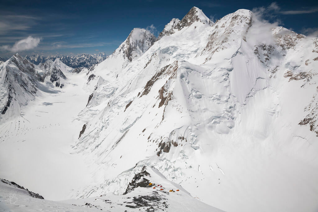
During the Gasherbrum I Expedition, many high camps were established throughout the ascent. These camps are critical rest stops, providing shelter and allowing climbers to recoup strength and acclimatize further. Climbers gradually gain altitude while managing their physical and mental well-being as they move from camp to camp.
Climbers who reach the summit of Gasherbrum I are rewarded with breathtaking views of the surrounding Karakoram Range and its snow-capped peaks. An enormous picture opens from the peak, showcasing the majestic splendor of vast glaciers, deep valleys, and distant mountain ranges stretching as far as the eye can see.
It is critical to recognize that the Gasherbrum I Expedition is fraught with danger. The mountain's rugged terrain, harsh weather, and technical difficulties have given it a reputation as a difficult and deadly climb. Proper training, prior expertise, and a seasoned crew are required to reduce dangers and ensure a safe and successful ascent.
The Gasherbrum I Expedition is an awe-inspiring and physically demanding journey that invites climbers to push their limitations, embrace nature's raw force, and revel in the unsurpassed grandeur of the Karakoram Range. It embodies the spirit of exploration, resilience, and human determination to scale great peaks, leaving an unforgettable impression on the climbing world.