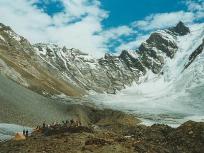
The Nanga Parbat Expedition is an awe-inspiring and difficult endeavor that involves summiting Nanga Parbat, one of the world's most fearsome mountains. Nanga Parbat, located in Gilgit-Baltistan, Pakistan, is the ninth-highest peak in the world, standing majestically at an elevation of 8,126 meters (26,660 feet).
Mountaineers from all over the world come to Nanga Parbat to put their abilities, endurance, and mental fortitude to the ultimate test. With its steep, icy slopes, unpredictable weather, and difficult terrain, Nanga Parbat offers climbers a daunting yet exhilarating trip.
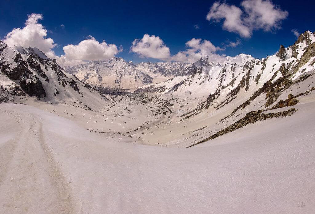
The expedition usually begins at Skardu, a little hamlet from where mountaineers head out to explore the beautiful Himalayan environment. The journey to the base camp takes you through stunning valleys, rich green meadows, and winding pathways with views of the surrounding snow-capped peaks.
Itinerary
The Itinerary for Nanga Parbat Expedition is noticeable below
Today's GPS Data Altitude: 540 m
Your planes will usually arrive in the afternoon in Islamabad. Our guide(s) will pick you up at the airport. The participants will be taken to hotels shortly. On this day, participants can unwind and recoup after their journey.
Today's GPS Data Altitude: 540 m
Before departing for Chillas, we will receive a briefing from the Department of Tourism about the Nanga Parbat Expedition in Islamabad.
Following the briefing, we will spend time exploring Islamabad and sampling traditional Pakistani cuisine.
Today's GPS Data Altitude: 1,265 m
The participants will take the Karakoram Highway to Chilas. To reach Chilas, they would go through the villages of Abbottabad, Mansehra, Besham, Dasu, and Sazin. Chilas is where participants will spend the night.
Today's GPS Data Altitude: 2,600 m
On this day of the Nanga Parbat Expedition, we will continue driving from Bunar Das to Halala Bridge. From here on out, we'll walk to Zangot and spend the night there.
Today's GPS Data Altitude: 3,100 m
On this day of the Nanga Parbat Expedition, we will hike from Zangot to Kutgali and spend the night there.
Today GPS Data Altitude: 4,000 m
On this Nanga Parbat Expedition day, we will travel from Kutgali to the Nanga Parbat Diamir Base Camp.
Today's GPS Data Altitude: 540 m
We shall begin our ascent to the mountain on this day and continue for the next four weeks. We will have backup days in case the weather improves. The Silkroad Guides Team will set up the Nanga Parbat Expedition's base camp and will continue to help the expedition throughout the time frame.
Today's GPS Data Altitude: 540 m
On this day of the Nanga Parbat Expedition, we retrace our ways from Nanga Parbat Base Camp to Kutgali.
Today's GPS Data Altitude: 2600 m
On this day of the Nanga Parbat Expedition, we retrace our travels from Kutgali to Zangot.
Today's GPS Data Altitude: 1,265 m
On this day of the Nanga Parbat Expedition, we return to Zangot through Halala Bridge and drive to the accommodation.
Today's GPS Data Altitude: 540 m
We will return to Islamabad on this day of the Nanga Parbat Expedition. We'll stop at regular intervals along the journey. We will arrive in Islamabad in the evening and spend the night at our hotel.
Today's GPS Data Altitude: 540 m
On this day, we will sign the final documents and attend the tourism department's debriefing. The remaining time will be spent exploring the city or relaxing at the hotel.
Meals for this day included: Breakfast
Our personnel will transport all of our customers to the airport at their scheduled departure times. All of our partner hotels have a 12pm check-out time.
Holiday Overview
Climbers must undergo intensive acclimatization once they arrive at base camp in order to acclimatize to the high altitude and thin air. They set up temporary camps at strategic spots along the mountain, gradually ascending and approaching the summit. Climbers can restore strength and acclimatize to the severe conditions at each camp, which provides shelter and respite.
The path to Nanga Parbat's peak differs depending on the expedition's itinerary. The regularly utilized Rupal and Diamir face present unique challenges and necessitates a variety of climbing approaches. Climbers face sheer ice walls, exposed ridges, and crevasses regardless of route, necessitating outstanding technical abilities and physical fitness.
The weather is critical in the Nanga Parbat Expedition because the mountain is infamous for its fierce storms and extreme temperatures. Climbers must be prepared for unexpected weather changes and be outfitted with appropriate gear to survive extreme cold, strong winds, and dangerous avalanches.
The expedition to Nanga Parbat is not for the faint of heart. It necessitates unshakable resolve, resilience, and collaboration. Climbers frequently establish close-knit groups, supporting and encouraging one another throughout the difficult climb.
Those who successfully conquer Nanga Parbat will be rewarded with an amazing sense of accomplishment and the opportunity to witness unrivalled panoramic views from the summit. Few have seen the huge expanse of snow-covered peaks, deep valleys, and far horizons.
However, it is important to recognise that the Nanga Parbat Expedition is an inherently dangerous endeavour. The mountain has gained the moniker "Killer Mountain" because to its difficult terrain and the tragic loss of many climbers' lives. To reduce the risks connected with such an adventure, safety precautions, good training, and experienced guides are essential.
The Nanga Parbat Expedition is a magnificent expedition that invites travelers to push their limits, face their anxieties, and marvel at nature's majesty. It is a combination of physical skill, mental fortitude, and a deep connection with the gorgeous mountains that leaves an everlasting impact on the hearts and minds of those who dare to embark on this incredible adventure.